Neal Hammon - Early Roads Into Kentucky

Neal Hammon
Click here for the video presentation
LINK -Neal Hammon
Neal Hammon is considered by most to be the most authoritative researcher of Boone Trace to date. Others who have made highly significant contributions would be Tom Shattuck, Jeff Renner and Tom Conforti, among more. Neal at the time of this writing is 85 years of age, still sharp as a razor, continuing to study, write and contribute. He drinks beer, drives a Lexus and can entertain with an endless string of pioneer stories and past experiences.
He was a respected architect in his earlier days and traveled around Kentucky doing jobs and hunting. He developed a curiosity and passion about Boone Trace and decided for the sake of future historians that the early roads into Kentucky needed to be re-studied and documented on modern-day maps before they were lost forever.
He wrote his definitive article on Boone Trace in 1970 called “Early Roads into Kentucky” published in the Register of the Kentucky Historical Society in April, 1970. Another very relevant paper on Boone Trace was “Boone’s Trace through Laurel County” published in 1968, and he also has written a book on Boone Trace, not yet published, based on the two above papers and gives deeper insight and interpretation on the subject of Boone Trace.
All of these documents, which can be found in their entirety on this website, should be read and studied while referring to the USGS maps he compiled showing the route of The Trace as it progresses north from the Cumberland Gap. They are also included on this site for easy convenience.
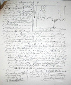
To research his project, Neal set about to visit county courthouses and make copies of early land surveys which many times used Boone Trace as a reference point on the survey.
These made by surveyors who flooded into Kentucky shortly after Daniel Boone opened up the trail through the Cumberland Gap with the intent to claim and sell land. The surveys were handwritten and usually had a diagram of the property in question with a rough drawing of the topography and streams or landmarks with Boone Trace often represented by a dotted line. Amazingly, they still are on file and available in the courthouses.
He would transcribe the hand-written portion so that it was more readable.
In Kentucky we are unique for having passed from the Stone age to our modern civilization in less than 200 hundred years. Prior to the first settlement in Harrodsburg in 1774, our boundaries had only contained Indian villages, and most of these had vanished long before the European set foot on this continent. Only one small Shawnee village, Eskippikithiki, is known to have existed in central Kentucky within the last 300 years, and even this site was abandoned prior to Daniel Boone's first trip into the bluegrass region.
Based on world standards, our historical situation is unusual; our first civilization was begun by our great-great grandfathers, some of whom are still remembered by the living. Many of the building that we pass were erected by these first pioneers and many of the nearby fields were sites of Indian skirmishes. Basically our history consists of a brief but bloody Colonial Period, followed by a rather stable agricultural age. The latter is now in the process of being supplanted by an industrial economy that began in the Commonwealth about the time of the first World War.
The roads of our state clearly reflect these three periods. First, only game trails and Indian paths were available to the early pioneers. Later when a stable government ushered in the second stage of our civilization, wagon roads were laid out that were adequate for the horse-drawn transportation of the day. With the coming of an industrial economy, these old roads are being rebuilt to accommodate the high-speed automobile traffic.
It is the purpose of the article to record, wherever possible, the exact locations of the early roads before they are lost to future historians. Although most of the early routes have already been improved, a few may still be traveled in their original condition, untouched by grader and bulldozer. Future [page 92] "progress" will surely eliminate not only the character, but even the knowledge of the locations of the old roads still in existence. It would be a noble project to trace and record all of the first roads in the state' such a task would require a large, well trained staff working full time for many hers. Thus, of necessity, this project is limited to the roads which entered the state from the old settlements and lead into the bluegrass or to the Falls of the Ohio.
In the beginning, so the history books relate, there was one main road leading northward from Cumberland Gap to the Ohio. This was the famous War Road or Warriors Path.....
Click here to read the rest of original article. "Early Roads Into Kentucky"by Neal Owen Hammon
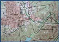
He would then superimpose this drawing with the topographic features including The Trace onto a USGS map. Finally, he would draw The Trace onto the new map using a CAD program (computer assisted drawing).
Thank goodness for his effort and genius, because we now to this day have a good evidence-based idea of where the actual route goes.
We owe a great debt to this man for his contribution in saving Boone Trace. Others have contributed as well, and now it is our turn to rescue and preserve it once and for all.
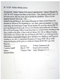
Then he would take the “calls” of the survey and put them on his 1970 MacIntosh computer. Calls are the segments of the survey from one point to another with a certain compass bearing, or angle, and length done in poles, 16 1/2 feet per pole. Two men would go to the site with a long chain and measure the property in poles at the proper angle to produce the survey drawing.
Neal would then change the scale of the drawing from poles to the scale of a USGS map and make his own corrected and re-oriented diagram on his computer.
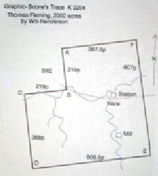
"Boone Trace - First Trip to Boonesborough" by Neal Owen Hammom
“Boone Trace - Into Laurel County” by Neal Owen Hammon
An excerpt from Neal Hammon’s original Article written in 1970.
© 2016 - 2023, ALL RIGHTS RESERVED
Friends of Boone Trace 1775
Website Maintained by Graphic Enterprises


